Longstep Property Solutions Homes for Rent
Andrew Glisson, Longstep Property Solutions
By Andrew Glisson, Longstep Property Solutions. I personally stand behind every number on this page.
Memphis crime map showing ZIP-level incident trends sourced from MPD open data

Memphis crime map, by the numbers.
Free. Open. Public.

Memphis is getting safer. Not slightly. Substantially. Overall crime is down 40% from its May 2023 peak , with every major category trending down for three years running. The story most people still tell about this city is years out of date. The current data is on this page.

Reported incidents from the Memphis Police Department's public feed. ZIP-level trends, address-level lookup, peak-hour patterns. Forty-one  months of data, refreshed daily. No paywall, no sign-up.

−23%
Overall crime YTD vs 2025
40 mo
Of MPD data
24
Memphis ZIP codes
$0
Paywall, ever
Headlines

Memphis crime, year to date.

Year-to-date figures through the most recent MPD daily release. Comparisons are against the same calendar window in the prior year.

Homicides YTD
82
42% YoY
vs 142 same date 2025
Vehicle Thefts
−61%
61% YoY
same-date YTD vs 2025
Robberies
−42%
42% YoY
same-date YTD vs 2025
Larceny
−37%
37% YoY
same-date YTD vs 2025
The Map

Crime by Memphis ZIP code.

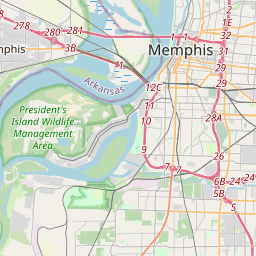
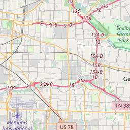
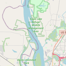
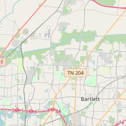
Pan and zoom anywhere in the city. Click any ZIP for its 12-month trend, peak hours, and how it compares to the citywide average. Color reflects the 12-month direction , not raw incident count.

LIVE · DATA THROUGH JUN 23, 2026
35.1495°N · 90.0490°W
Loading map · MPD feed
38119
38116
38111
38134
38104
38122
38135
38128
38107
38114
38109
38127
38120
38103
38115
38118
38106
38108
38133
38112
38141
38117
38125
38105
Leaflet © OpenStreetMap contributors
12-month
trend
Down ≥18% Down 12–17% Down 6–11% Flat / mixed
Citywide Trend · 41 Months

The full arc of Memphis crime, 2023 to 2026.

Three years and five months of reported incidents, including the city's homicide-record year, the inflection in mid-2024, and the sustained decline through 2026.

Violent crime · FBI Part 1 (right axis)
Property incidents (left axis)
Source, MPD Public Safety Incidents
Swipe to see the full 40-month trend
8k1.2k6k9004k6002k30000242526Jul 2023Highest homicide year on recordMid-2024Trajectory turnsMay 26933Jan 23May 23Sep 23Jan 24May 24Sep 24Jan 25May 25Sep 25Jan 26May 26
Y-axis, incidents per month, citywide
X-axis, Jan 23 to May 26
Address Lookup

Check crime near any Memphis address.

Block-level incident count, 12-month trend, peak-risk hours, and most common incident type. Designed for investors evaluating a specific property before they buy.

Enter a Memphis address
Free · No account · Quarter-mile radius · Results pull from the MPD public feed.
Radius 0.25 mi
Window Trailing 12 months
Source MPD daily feed
Updated Refreshed daily
Free Property Breakdown

Get the full safety + rent breakdown for this address.

The lookup above is the quick view. We will pull the full picture for your address by hand: block-level incident detail, what the property should rent for backed by real nearby comps, and what similar homes actually collect. Free, no obligation, delivered within one business day.

Free. No account required. Prepared by Longstep Property Solutions, (901) 244-2911. By submitting, you agree that Longstep Property Solutions may contact you by phone, text, or email about your property, including by automated means. Consent is not a condition of any purchase. Message and data rates may apply. Reply STOP to opt out. Privacy Policy · Terms

Time of Day · 24 Hours

When does Memphis crime peak?

Static maps treat 4 am and 7 pm the same. They aren't. Distribution of reported incidents across the 24-hour clock, trailing twelve months, all incident types.

12a
·
·
3a
·
·
6a
·
·
9a
·
·
12p
·
·
3p
·
·
6p
·
·
9p
·
·
Peak: 8 pm to 11 pm. Quietest: 9 am to noon.
All incident types · Trailing 12 months
Same-date YTD · 2025 vs 2026

Every major category declined.

Property crime, violent crime, and vehicle theft all declined in 2025 against 2024. The declines have continued into 2026 across categories.

Larceny
-37% YoY
2025 YTD11,077
2026 YTD6,946
Aggravated Assault
-28% YoY
2025 YTD3,143
2026 YTD2,269
Robbery
-42% YoY
2025 YTD822
2026 YTD475
Burglary
-29% YoY
2025 YTD2,059
2026 YTD1,465
Motor Vehicle Theft
-61% YoY
2025 YTD3,433
2026 YTD1,344
Homicide
-42% YoY
2025 YTD142
2026 YTD82
Why this exists

Why is a property management company publishing a crime map?

Two reasons. Plus the conviction behind both.

The honest one. Memphis publishes excellent open data and almost nobody uses it. The Memphis Police Department's incident feed contains every reported event, on a public ArcGIS endpoint, refreshed every day. Existing Memphis crime maps are paywalled, three years out of date, or sell home-security products in the margins. We built a free, current interface because the data belongs to Memphis, not to platforms that monetize it.

The obvious one. Yes, we manage rental properties in Memphis. Yes, we benefit when the city's reputation tracks its actual data. So does every small business owner, every homeowner watching property values, every neighbor on a block that's getting safer, and every city worker whose budget depends on local economic activity. We're not hiding the interest. We're trying to be useful with it.

We will also say this out loud: we believe in Memphis. For most of the last decade the national story about this city has been a single word. Dangerous. We hear it from out-of-town investors on every first call. The data tells a different story now. Homicides down. Carjackings down. Property crime trending down three years running. Memphis is not what it was in 2022, and we built this page to make that visible. The fuller economic case is on our why we believe in Memphis page.

About this data

How to read this, and how not to.

This page shows reported incidents from the Memphis Police Department's public feed, nothing more. Reported crime is not total crime: events that go unreported or unsolved are in no public dataset, here or anywhere. Counts also track population and foot traffic, so a busy commercial ZIP and a quiet residential one are not directly comparable, which is why the map is colored by 12-month direction rather than raw counts.

Crime data does not measure how safe a place is, and it says nothing about the people who live there. We publish the same public figures for every Memphis area, rate no neighborhood as good or bad, and intend this as one factual input among many. It is not a basis for any assumption about the residents of any area, and it is not legal, investment, or fair-housing advice.

From LPS

Own, rent, or buy in Memphis? Start here.

This map is free for everyone. Where you go next depends on why you're here. If you already own a Memphis rental, we'll send you a free rental analysis and can manage it end to end, long-term or Airbnb. Buying or investing? Pull what any address earns as a rental first. Renting? Browse the Memphis homes we have available now.

Longstep Property Solutions · 3638 Park Ave · Memphis TN 38111
+1 (901) 244-2911
Frequently Asked

Memphis crime data, answered.

The questions investors ask before they buy.

Generic crime maps drop pins on a citywide view that hasn't been updated narratively since 2022. Investors evaluating a specific Memphis property need ZIP-level direction, peak-hour patterns, and address-level context. This map provides all three using the city's own public feed, with no paywall.
Citywide trend data on this page runs from January 2023 forward, capturing the city's homicide-record year, the inflection point in mid-2024, and the sustained decline through 2025 and 2026. The underlying Memphis Police Department dataset goes back to January 2019 and is the source for all numbers shown here.
The Memphis Police Department refreshes its public incident feed once per day. This page automatically pulls the latest available snapshot of that feed each morning, so every number you see reflects the most recent MPD data available.
The data is sourced from the Memphis Police Department's Public Safety Incidents feed, published openly by the City of Memphis on its data hub (data.memphistn.gov). The feed is refreshed daily by 6am Central. We aggregate and visualize it. We do not modify the underlying incident records.
The 'violent crime' line on the trend chart follows the FBI's UCR Part 1 violent crime index: homicide, aggravated assault, robbery, kidnapping, and arson. This is the same definition the Memphis Police Department, the FBI, the Tennessee Bureau of Investigation, and the U.S. Department of Justice use when they publish 'violent crime' statistics. Simple (non-aggravated) assault is reported by MPD as a Part 2 offense and is not included in the violent bucket; it appears in the 'overall crime' headline number and in the broader incident count. We use the Part 1 definition so the violent-crime trend on this page matches what every official source publishes.
Through May 2026, the strongest 12-month declines have been concentrated in 38119 (Far East, −40%), 38117 (East Hub, −40%), 38133 (Bartlett N, −36%), and 38120 (Eads/Riverdale, −35%). The interactive map shows the current direction for all Memphis-area ZIP codes.
No. The Memphis Police Department excludes sex crimes and juvenile-specific crime types from the public dataset. That exclusion is set by MPD and applies to anyone using the public feed.
Yes. Use the address lookup on this page to see the 12-month incident count within a quarter-mile radius, the trend direction, the most common incident type, and peak-risk hours. The lookup is free and requires no account.
Yes. The Memphis Crime Map will never be placed behind a paywall. The underlying data is public, the visualization is built on free open-source tooling, and the project is published under an open license.
The Memphis Crime Map is published by LPS (Longstep Property Solutions), a Memphis-based property management company. We built it for two reasons: the Memphis Police Department's incident feed is public open data that almost nobody surfaces well, and we believe Memphis is in the middle of a real, measurable safety turnaround that the national narrative has not yet caught up to. We are an independent project, not affiliated with MPD or the City of Memphis.